
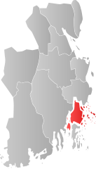
File:NO 0722 Nøtterøy.svg

Size of this PNG preview of this SVG file: 342 × 599 pixels. Other resolutions: 137 × 240 pixels | 274 × 480 pixels | 439 × 768 pixels | 585 × 1,024 pixels | 1,170 × 2,048 pixels | 449 × 786 pixels.
Original file (SVG file, nominally 449 × 786 pixels, file size: 61 KB)
| Description | |||
| Date | |||
| Source | Own work | ||
| Author | Jon Harald Søby | ||
| Permission (Reusing this file) |
|
||
| SVG genesis |
File history
Click on a date/time to view the file as it appeared at that time.
| Date/Time | Thumbnail | Dimensions | User | Comment | |
|---|---|---|---|---|---|
| current | 10:17, 8 January 2017 | | 449 × 786 (61 KB) | Bjarkan | Map of Nøtterøy. Borders updated for 2017. |
| 17:44, 22 January 2007 |  | 449 × 786 (76 KB) | Jon Harald Søby | {{User:Jon Harald Søby/Kartlisens|Nøtterøy|Vestfold}} |
File usage
The following page uses this file:
Global file usage
The following other wikis use this file:
- Usage on ar.wikipedia.org
- Usage on ay.wikipedia.org
- Usage on bpy.wikipedia.org
- Usage on ca.wikipedia.org
- Usage on da.wikipedia.org
- Usage on en.wikipedia.org
- Usage on es.wikipedia.org
- Usage on et.wikipedia.org
- Usage on fa.wikipedia.org
- Usage on fi.wikipedia.org
- Usage on fr.wikipedia.org
- Usage on hu.wikipedia.org
- Usage on hy.wikipedia.org
- Usage on it.wikipedia.org
- Usage on ka.wikipedia.org
- Usage on la.wikipedia.org
- Usage on li.wikipedia.org
- Usage on nds.wikipedia.org
- Usage on nl.wikipedia.org
- Usage on nn.wikipedia.org
- Usage on no.wikipedia.org
- Usage on pl.wikipedia.org
- Usage on pnb.wikipedia.org
- Usage on pt.wikipedia.org
- Usage on qu.wikipedia.org
- Usage on ro.wikipedia.org
- Usage on ru.wikipedia.org
- Usage on se.wikipedia.org
- Usage on sq.wikipedia.org
- Usage on th.wikipedia.org
- Usage on tr.wikipedia.org
- Usage on ur.wikipedia.org
- Usage on vi.wikipedia.org
- Usage on zh-min-nan.wikipedia.org