
File:Republican River from NE47 DS.JPG

Size of this preview: 800 × 600 pixels. Other resolutions: 320 × 240 pixels | 640 × 480 pixels | 1,024 × 768 pixels | 1,280 × 960 pixels | 2,560 × 1,920 pixels.
Original file (2,560 × 1,920 pixels, file size: 2.39 MB, MIME type: image/jpeg)
Summary
| Description |
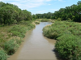
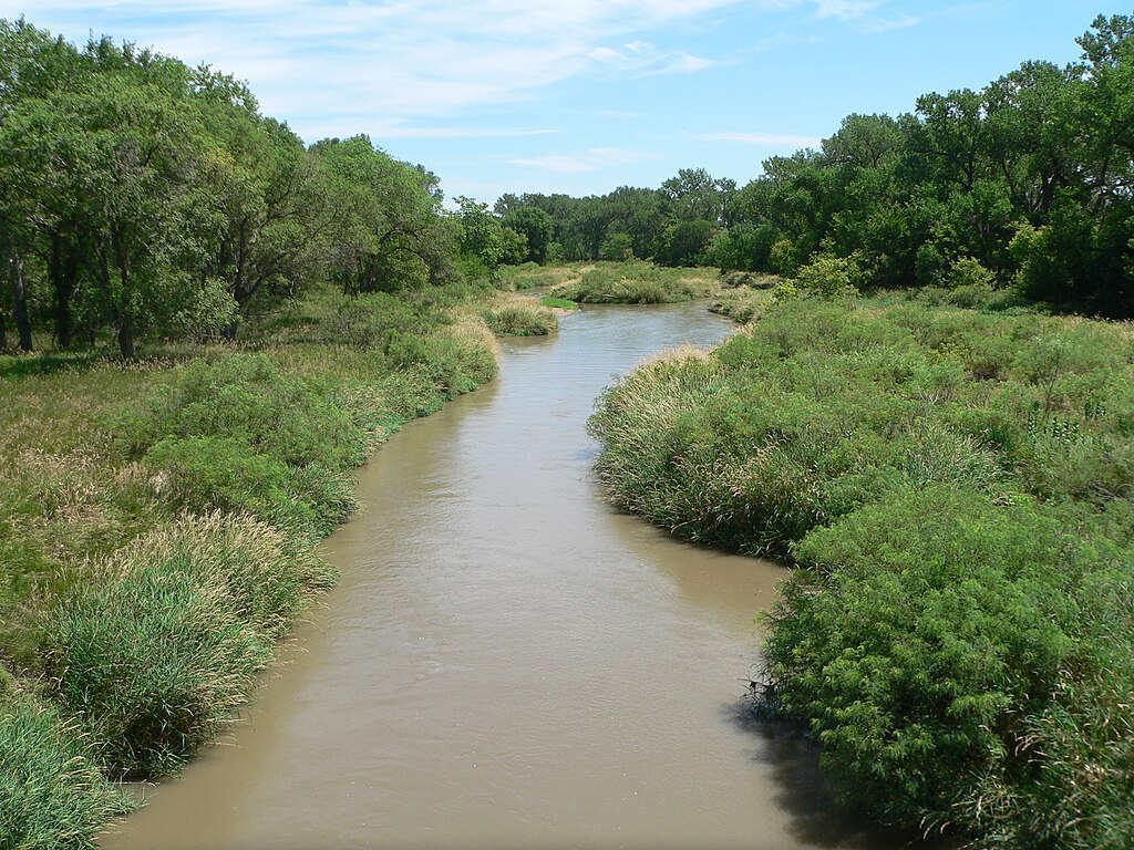
English: Republican River, looking downstream (eastward) from Cambridge State Aid Bridge (Nebraska Highway 47 crossing), just south of Cambridge, Nebraska. |
| Date | |
| Source | Own work |
| Author | Ammodramus |
| Camera location | | View this and other nearby images on: OpenStreetMap |
|---|
Licensing
| I, the copyright holder of this work, release this work into the public domain. This applies worldwide. In some countries this may not be legally possible; if so: I grant anyone the right to use this work for any purpose, without any conditions, unless such conditions are required by law. |
File history
Click on a date/time to view the file as it appeared at that time.
| Date/Time | Thumbnail | Dimensions | User | Comment | |
|---|---|---|---|---|---|
| current | 15:57, 26 July 2010 | | 2,560 × 1,920 (2.39 MB) | Ammodramus | {{Information |Description={{en|1={{w|Republican River}}, looking downstream (eastward) from {{w|Cambridge State Aid Bridge}} ({{w|Nebraska Highway 47}} crossing), just south of {{w|Cambridge, Nebraska}}.}} |Source={{own}} |Author=[[User:Ammodramus|Ammodr |
File usage
The following page uses this file:
Global file usage
The following other wikis use this file:
- Usage on pl.wikipedia.org