
File:Arkansasrivermap.jpg
No higher resolution available.
Arkansasrivermap.jpg (771 × 533 pixels, file size: 259 KB, MIME type: image/jpeg)
Summary
| Description |
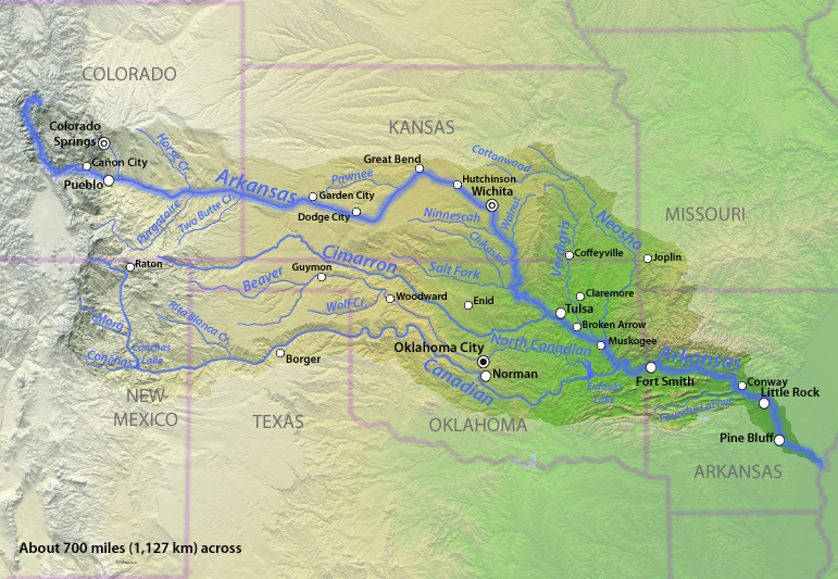
English: Map of the Arkansas River watershed in the south-central United States. |
| Date | |
| Source | Drawn by myself; shaded relief data from NASA SRTM North America imagery here |
| Author | Shannon1 |
Licensing
I, the copyright holder of this work, hereby publish it under the following licenses:

|
Permission is granted to copy, distribute and/or modify this document under the terms of the GNU Free Documentation License, Version 1.2 or any later version published by the Free Software Foundation; with no Invariant Sections, no Front-Cover Texts, and no Back-Cover Texts. A copy of the license is included in the section entitled GNU Free Documentation License. |
This file is licensed under the Creative Commons Attribution-Share Alike 4.0 International, 3.0 Unported, 2.5 Generic, 2.0 Generic and 1.0 Generic license.
- You are free:
- to share – to copy, distribute and transmit the work
- to remix – to adapt the work
- Under the following conditions:
- attribution – You must give appropriate credit, provide a link to the license, and indicate if changes were made. You may do so in any reasonable manner, but not in any way that suggests the licensor endorses you or your use.
- share alike – If you remix, transform, or build upon the material, you must distribute your contributions under the same or compatible license as the original.
You may select the license of your choice.
File history
Click on a date/time to view the file as it appeared at that time.
| Date/Time | Thumbnail | Dimensions | User | Comment | |
|---|---|---|---|---|---|
| current | 23:07, 21 November 2010 | | 771 × 533 (259 KB) | Shannon1 | {{Information |Description={{en|1=Map of the Arkansas River watershed in the south-central United States.}} |Source=Drawn by myself; shaded relief data from NASA SRTM North America imagery [http://www2.jpl.nasa.gov/srtm/northAmerica.htm here] |Author=[[Us |
File usage
There are no pages that use this file.
Global file usage
The following other wikis use this file:
- Usage on af.wikipedia.org
- Usage on be-tarask.wikipedia.org